Photography is an invaluable tool in the understanding and appreciation of our built and natural environments. Former Foster + Partners architect Michael Elkan has been capturing both structures and landscapes with his camera throughout his career. In this special feature for +Plus, he walks us through a selection of his landscapes; images that draw on and reflect his training and perspective as an architect and which, at the same time, seek to highlight the astounding beauty and increasing fragility of our natural world.
15th September 2020
Visual Tectonics: Observing the World Through an Architect’s Lens
Seeing in perspective
Since their parallel beginnings in the nineteenth century, photography and modern architecture have maintained a close, collaborative relationship. Today, this relationship is as strong as ever, as photography continues to be the primary medium through which architecture is publicised and made known.
Through photographs, the world we experience is transposed into a narrow bandwidth of static perception. However, we have learned to interpret these images as realistic representations of the experienced world. I first became aware of theories of visual perception – that we see not with our eyes, but with our minds – as a student in the early 1970s; the images we make as photographers are not reality as we fully experience it, but two-dimensional abstractions of our imagination.
This insight later informed the visual communication methods that shaped my career in architecture. As architects, we have long communicated our multi-dimensional ideas through more legible two-dimensional media, to make sure that everyone involved in the design process is aligned. However, it is not until the building takes physical presence on site that we can all begin to experience the same spatial perception. The making of photographs of the finished building is, then, a return to the process of translating spatial reality back into two dimensions. Understanding how visual perception works, photographers can intentionally construct photographs to convey the illusion of space and three-dimensionality. In my work as an architectural, and now environmental, photographer, I refer to this creative process as ‘visual tectonics’.
Like architecture and photography, our built and natural environments are inextricably linked.
Like architecture and photography, our built and natural environments are inextricably linked; the latter affords and inspires our architectural pursuits, and the former can shape and affect our natural world. Image-making is a means of accessing and appreciating some of the most remote areas of our planet and providing us with a tool for recording their evolution – something that is increasingly affected by human intervention.
In this photographic essay I share a few of my most memorable photos, and seek to document the relationship between my architectural and environmental photography. Both of these disciplines have been informed by, and are interconnected with, my professional training and work as an architect. Thus, I hope that through the exposition of the photography shared here, we can expand our architectural and environmental field of vision.
Architectural understanding
I first encountered the intersection of photography and architecture as a student at the Bartlett School of Architecture in London in the 1970s; here we were routinely treated to the ubiquitous twin-carousel slide lectures of the time. This was a period of intellectual flux when the prevailing modernist design ideology of the profession was being challenged by theories of academic post-modernism.
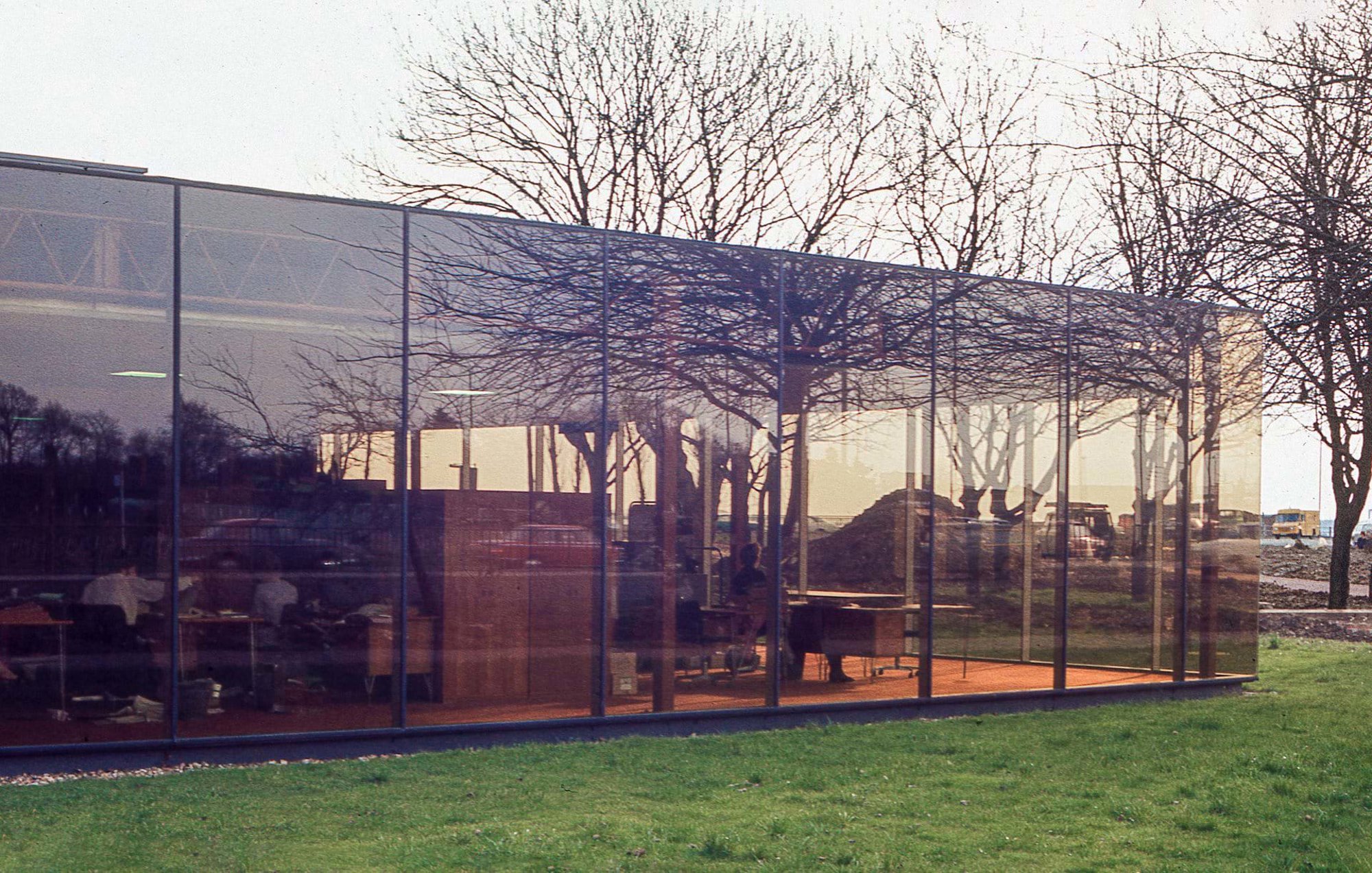
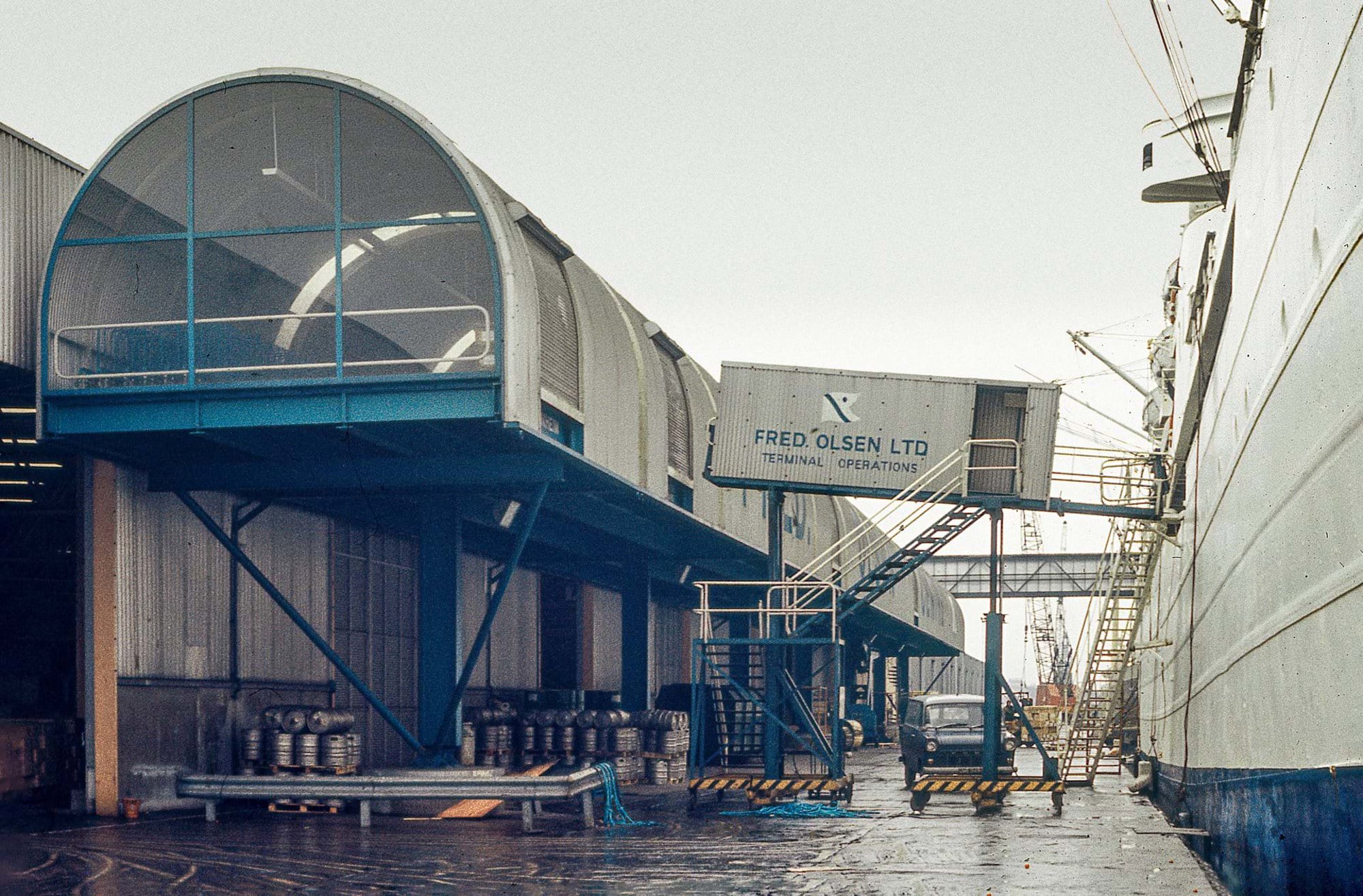
It was in this disorientating time that Norman Foster visited the School and presented slides of early projects by Foster Associates with a clarity that was both refreshing and inspirational. After hearing Norman’s lecture, I promptly took my camera to see some of the projects for myself: the IBM Pilot Headquarters in Cosham (1971) and the Fred Olsen Amenity Centre and Passenger Terminal in the Millwall Docks, London (1970). Two years later, in 1978, I would embark upon my career as a newly qualified architect at Foster Associates, part of their twenty-five-person London studio on Fitzroy Street.
Much has been written about the design rationale of the IBM Pilot Headquarters, a seminal project in the studio’s oeuvre. On first seeing that horizontal ribbon of frameless glass reflecting the surrounding landscape, I was stunned by its essential minimalism.
My student snapshots of the practice’s work had a didactic intent. I hoped to record the buildings’ architectural qualities: conceptual transparency and systems legibility. The images of IBM expose these ideas through a focus on the glass façade and its material contradiction: it is at once reflective and transparent, here multiplying the treescape while also revealing the structural and interior systems.
Visually communicating architectural ideas through photography is essential to the process of design, construction and completion.
While working at Foster Associates, I noticed that visually communicating architectural ideas through photography was essential throughout the process of design, construction and completion. This was evident in the office’s comprehensive and systematically curated 35mm slide library, which was in constant use.
I also realised that a camera can be a time machine. The photos I took of the IBM headquarters and the Fred Olsen buildings captured unrepeatable moments. I would now be hard-pressed to identify the site of the Fred Olsen terminal in the former Millwall Docks – the building was sadly demolished in the early 1980s. The legacy we have consists primarily of photographs, together with our collective memory, informed by drawings, articles and interviews.
Photographing architecturally
As well as providing windows through time, the photographic image is also a means to traverse instantaneously through space. In the studio’s slide library were images not only of its architectural output but also of its many and varied interests and influences. Part of this collection was Foster’s own imagery from his time spent in The United States in the 1960s: images of the California Case Study houses by the likes of Richard Neutra and Charles and Ray Eames, Ezra Ehrenkrantz’s School Construction Systems Development (SCSD) project, as well as the grand sweep of American highways, sleek Airstream trailers, and the rockets and launching pad structures of Cape Canaveral.
At the end of the 1970s, similarly enamoured with American architecture and urban design as Foster was in the 1960s, I would visit the country for myself. In 1979, I took a sabbatical and traversed the United States, coast to coast. I researched and photographed the influential projects that were informing my thinking as a young architect and which had previously been accessible to me only through the spatial and temporal portal of photography. After four months travelling, I returned with my own archive of over 2,000 Ektachrome 35mm slides.
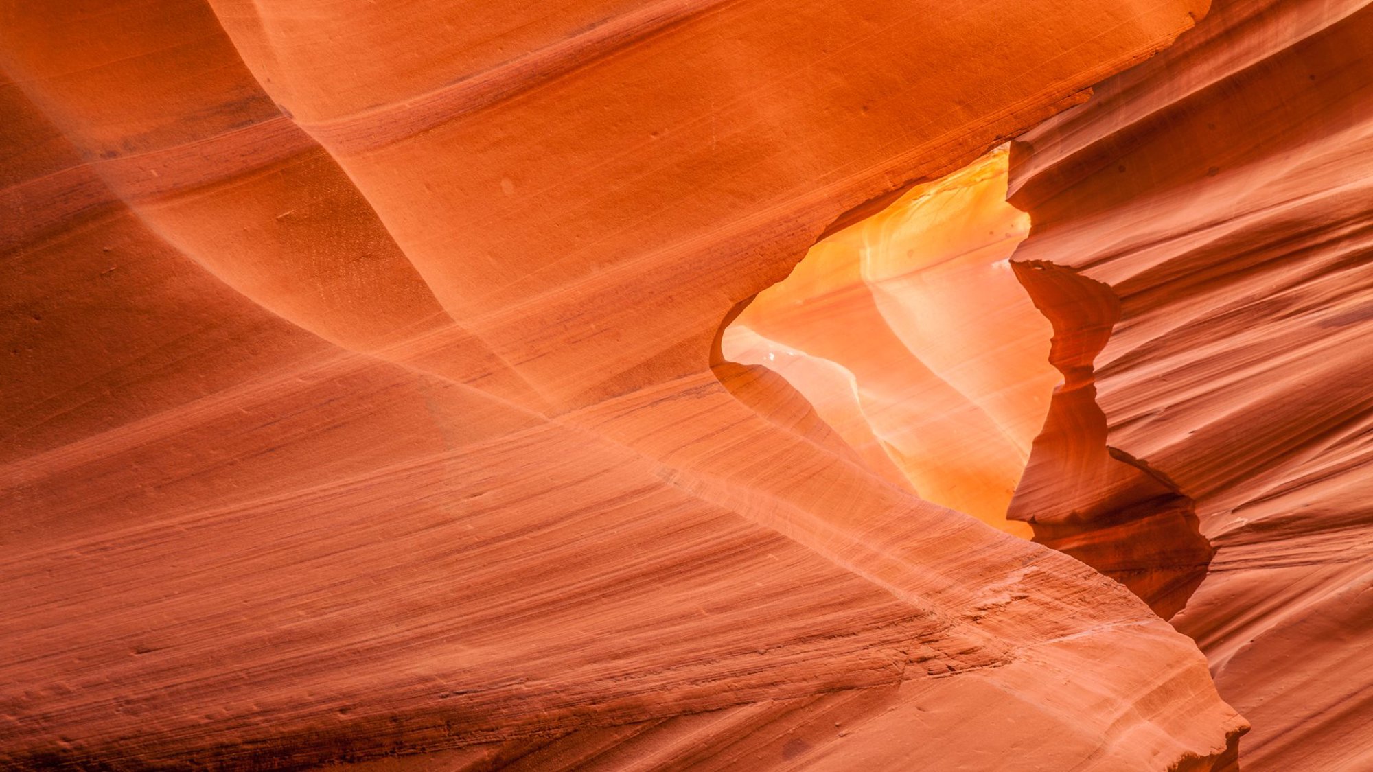
It was on this trip, travelling by Greyhound bus through New Mexico, Arizona and Utah, that I first encountered the desert landscapes of the American Southwest; something I had previously seen only in films. As an architecturally trained photographer, I became attracted to this elemental, luminous landscape of natural architectonic structures, each with a form that expressed the processes by which they were created.
Architects can learn much from observing the forces at play in their environments – from weather and climate to flora and fauna – and their effects on the natural tectonic structures within them. In Arizona, tectonic processes forming the landscape operate on varying timescales, ranging from millions of years to mere days; the building and erosion of mountain ranges, the carving of canyons and the daily reconfiguration of wind-blown sand dunes. As an architect attuned to the time-related processes of design, construction and entropy in building systems, I found myself as interested in these grand American landscapes, and the natural processes working through time to form and change them, as I was the architectural and urban projects I’d set out to document.
Geological formations are often described in architectural terms: slabs, walls, towers, bridges, arches, spires and buttresses.
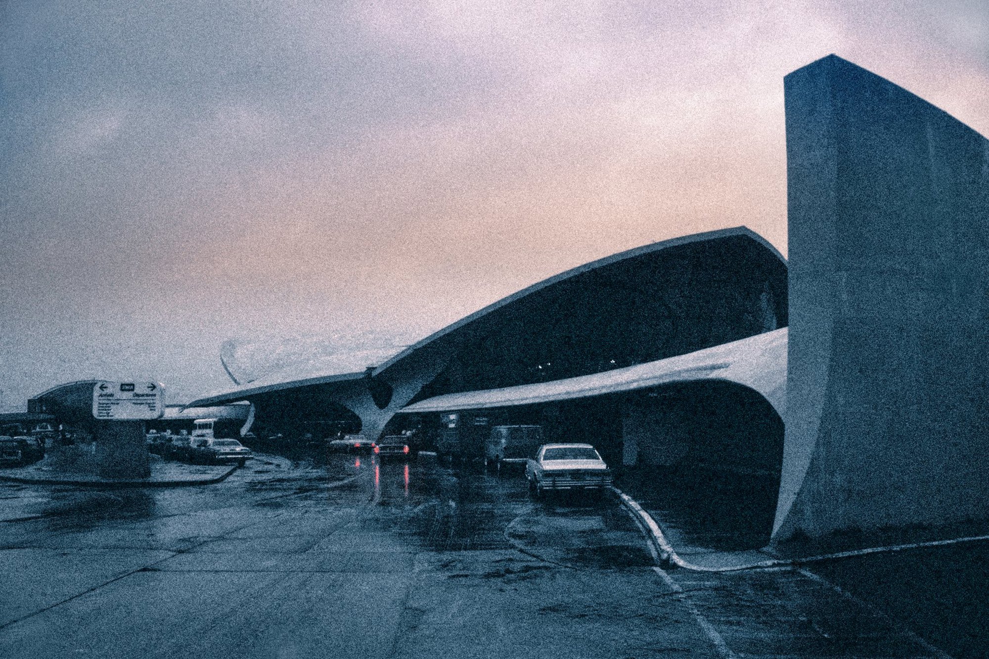
It's unsurprising, therefore, that geological formations are often described in architectural terms: slabs, walls, towers, bridges, arches, spires and buttresses. And architects often look to nature for inspiration. Eero Saarinen’s TWA Terminal at JFK, New York (1962) – captured on a rainy dawn just before flying back to London – adopts the form of an eagle landing at high speed, frozen in time with its talons and wings outspread. I later realised I’d composed this image from the same viewpoint as iconic black and white photographs of the newly opened terminal, shot by Ezra Stoller or Balthazar Korab, an architect and photographer embedded in Saarinen’s studio.
Korab described himself as ‘an architect with a passion for nature’s lessons and man’s interventions,’ and so it is unsurprising that, decades apart, we were drawn to capturing angles of the TWA Terminal that appear especially organic and geological. When viewed alongside my photograph of a desert slot canyon in Arizona, for example, these parallels with natural forms are particularly evident. There is an organic quality to the concrete forms; they resonate not only with the visceral quality of a bird of prey in flight but also with some of the tectonic phenomena that slowly shape the seemingly immovable structures I saw in the desert.
Saarinen, it seems, was also aware of the power that the monumental had alongside the more fleeting symbolism of the formal flight metaphor: ‘To some people it looked like a bird in flight,’ he explained, ‘but this was really coincidental … the last thing we ever thought about.’ Instead, he appears more concerned with its potential to resonate across the centuries. Reacting to the emergence of the monumental concrete forms during construction, Saarinen wrote to his wife: ‘I think it would make a beautiful ruin, like the Baths of Caracalla.’
Elemental Landscapes
The archives of Korab, Stoller and other notable mid-century photographers have enabled us to travel through space and time to experience the Modernist revolution in architecture and urban design that overhauled the landscape of the United States. Although architects like Saarinen were evidently inspired by the natural and organic, the rate of change in development in America was in direct contrast to the longevity of its vast landscapes. However, as our climate crisis deepens, we have become increasingly aware that the natural and the manmade are much more directly connected than we had perhaps been conscious of in the 1950s and ’60s.
The planet’s polar regions, for example, are the most sensitive global indicators of our changing climate, where – unlike the imperceptible evolutions of the ancient desert – the rate of change is now rapid.
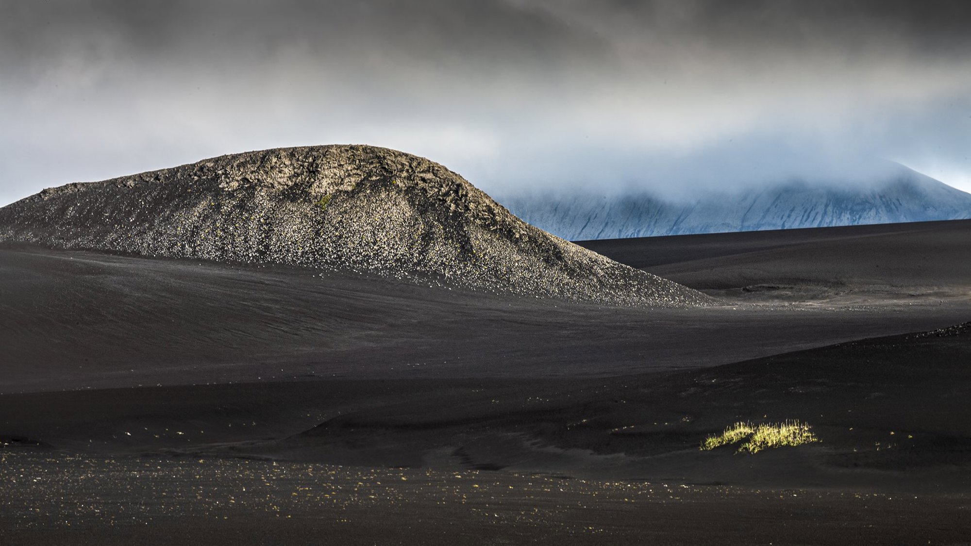
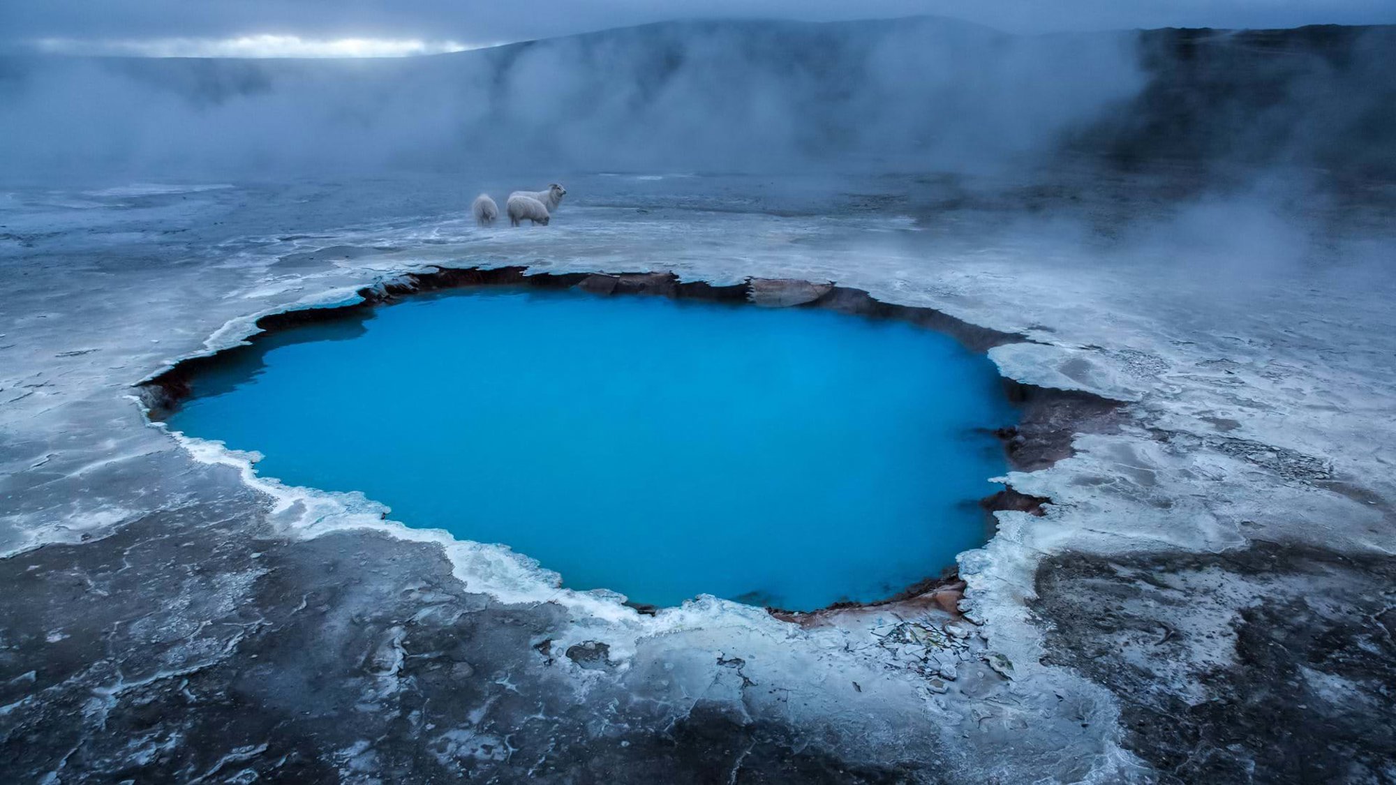
I first started exploring these areas with a visit to Iceland in 2008. Like the American Southwest, Iceland is a desert environment, but comparatively young geologically. Iceland has been shaped by relatively recent glaciation and subsequent volcanic activity. While the interior is a treeless black sandscape, punctuated by sparse iridescent green vegetation, active areas with hot springs and geysers are characterised by colourful mineral deposits.
An understanding of the natural processes that form a landscape helps shape the visual narrative in my environmental imagery.
My approach to photographing landscapes is similar to that of capturing buildings. When constructing a visual narrative as an architectural photographer, after first listening to the architect discuss the conceptual ideas underpinning the project, I spend time with the building, contemplating its overall form and structure, materiality and environmental context. My aim is to convey to the viewer something of the sensory experience of being present within the building. I look for details that speak of the coordination of systems, components and materials; this is the intimate scale at which we physically interact with buildings.
Similarly, an understanding of the natural processes that form a landscape helps shape the visual narrative in my environmental imagery. In the wilderness, I aim to impart to the viewer a visceral sense of being there. As well as communicating scale and space, this includes capturing elements and processes that demonstrate the physical forces at work in these environments, whether wind, water, ice, light or human intervention.
Northern latitudes
In 2014, I joined a photographic expedition to northeast Greenland and Svalbard. Our mobile base was a former Soviet polar research ship built in 1982, now operated by Aurora Expeditions. The voyage took fifty passengers northwards up the east Greenland fjords, then across the Arctic Sea to Svalbard into the pack ice, 500 kilometres (311 miles) from the North Pole. The expedition ventured deep into the fjords to where the interior glaciers flow down to sea level and break off into gigantic icebergs.
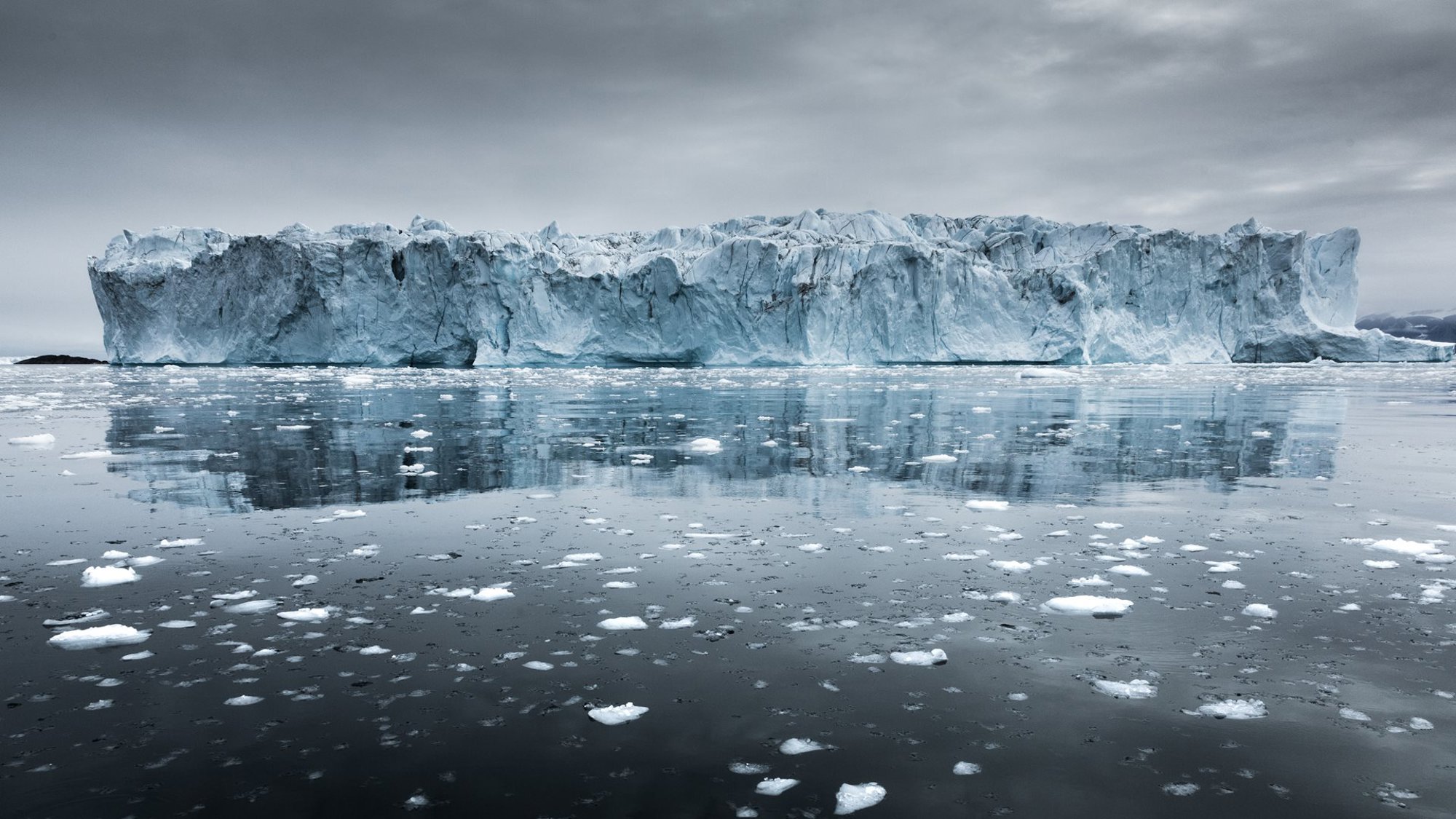
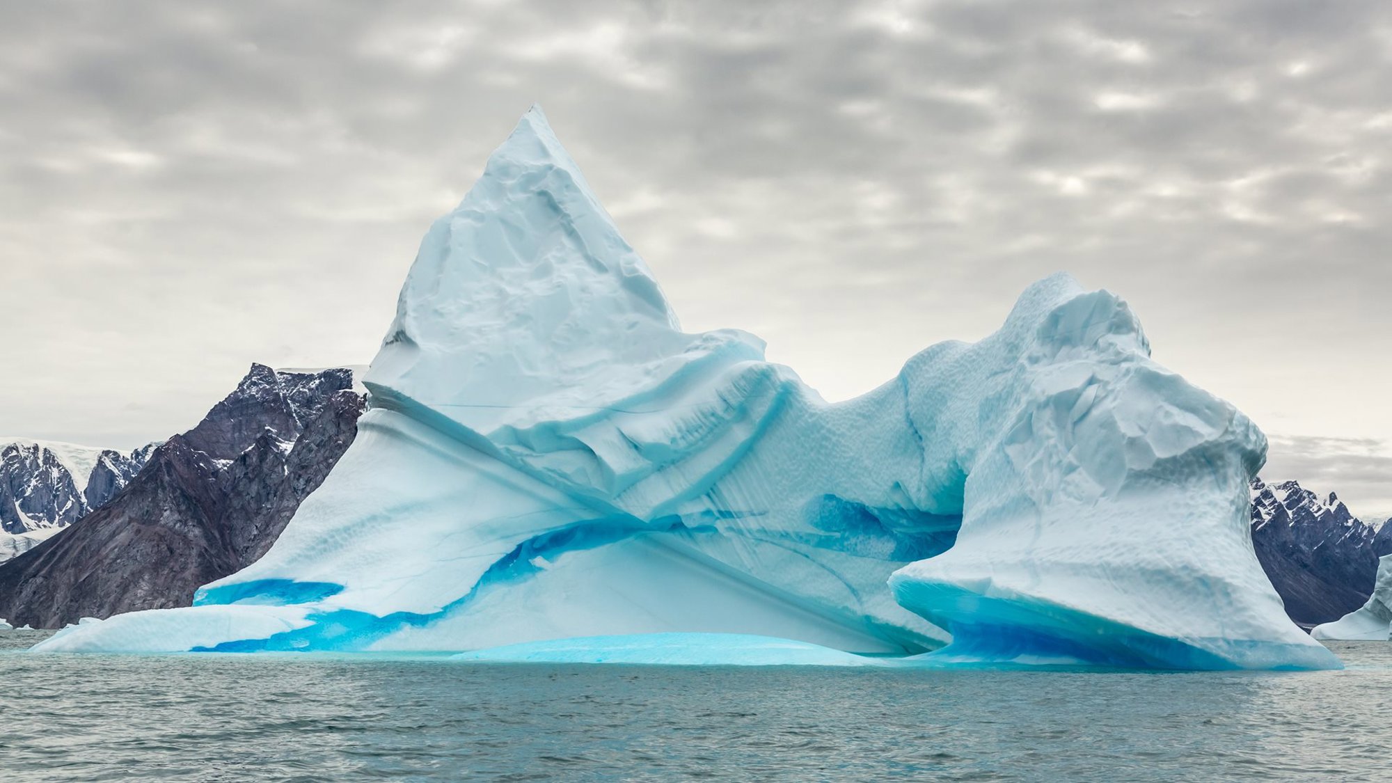
As an architect, I am naturally drawn to the tectonic forms of giant icebergs, and they have become a frequent subject of my photography. My images play with scale and depth of field in an attempt to translate their massive size and slow but unrelenting movement into a static and two-dimensional photograph. The images of the icebergs off the coast in Nordbugt speak of the constantly changing equilibrium between the iceberg’s mass and the weight of water it displaces, along with the mystery of the invisible 90 per cent below the surface. The floating debris in the image of the isolated tabula iceberg in Scoresbysund is evidence that it is actively shedding its ice and changing form as the waterline undercuts its cliff edges.
Photography is able to make a startling record of the profusion of massive icebergs in the fjord, evidence of accelerating glacial flow off the land into the ocean, which is contributing to a rise in sea levels. At the Bartlett in the early 1970s, we were already becoming aware of emissions-driven climate change and the dangers of environmental degradation. It became clear that the architectural profession had a responsibility and opportunity to help mitigate the impending crisis. I was particularly influenced by the ideas of the Scottish landscape architect Ian McHarg in Design with Nature (1969), and by the inventor, theorist and polymath Richard Buckminster Fuller – known as Bucky – and his book Operating Manual for Spaceship Earth (1969). It was inspiring, then, to see Norman Foster collaborating with Bucky and hear him describe how concerns for environmental stewardship were informing his conceptual thinking and underpinning the work of Foster Associates. At the time, the Gomera Regional Planning Study of 1975 presented a self-sustaining masterplan for the declining island (part of the Canary Islands off the coast of Spain) that raised issues of sustainability long before the ‘green’ agenda was being addressed worldwide.
Like all photography, iceberg images capture unique moments in time. But, while affording us this opportunity to record singular and unrepeatable moments in an iceberg’s lifecycle, the static representations also offer – like the rings of a tree – a legible depiction of the iceberg’s history.
During the expedition, on-board glaciologists described the iceberg formation process, explaining how they are constantly changing shape and orientation in the water as sections break away. Each time, the centre of mass shifts and the iceberg rotates, sometimes capsizing. These movements leave a unique record on each iceberg showing where the water line had previously melted the ice. Seen in two dimensions, these imprints become clearly visible as lines and strata etched into the ice’s surface, sculpting its form.
In Greenland, the kinetic and changing nature of two worlds – the natural and the manmade – are colliding with potentially tragic consequences.
The shifting nature of icebergs in response to environmental forces has echoes in our built environment, also. We have become accustomed to seeing static photos of architecture in print or online. Photographs of well-known buildings – like Korab or Stoller’s – have become embedded in our iconography. However, buildings are never static. They are continually changing in response to how they are used and subject to changes in their environment. Every time we visit a familiar building, it is a new experience. We are sometimes disorientated by how a well-known building has changed since it was first photographed and published.
Before departing Greenland, our expedition was hosted by the most northern Inuit community on the east coast, overlooking the Kangertittivaq fjord. Here, the kinetic and changing nature of two worlds – the natural and the manmade – are colliding with potentially tragic consequences. Like Gomera in the 1970s, the area is at risk of real decline, the natural evolution of the place and its architecture has been overcome by an acceleration of ecological change. Local hunters have made a living here from whale, seal and polar bear hunting for generations. However, this traditional cultural economy is now under threat as rising temperatures make winter sea-ice less reliable for dog-sled travel and hinder the seasonal migration of polar bears. Melting permafrost is also causing buildings in the village to subside and become unusable.
The work of influential Canadian photographer, Edward Burtynsky, has shown that environmental photography can be beautiful while at the same time present a troubling hidden reality.
While I was initially attracted to the polar regions by the seductive beauty and architectural grandeur of these remote landscapes, today images of the glaciers, icebergs and communities that live with and among them, embody a serious message that cannot be ignored. Nature photography in the polar regions is now more than an aesthetic indulgence or a record of human adventure, it is an essential conduit for a troubling narrative and conveys an urgent warning.
Journeying south
In 2018, I headed south to the remote Antarctic Peninsula and its many offshore islands. Reaching Antarctica is arduous; departing from Tierra del Fuego, near Cape Horn in southern Chile, it involves a two-day crossing of the infamous, storm-lashed Drake Passage. On arrival in sheltered Antarctic waters, the effort is rewarded by an icescape of vast proportions. Penguin colonies of various species populate the ice-covered terrain while the skies are patrolled by albatross, skuas and terns and the waters are home to a variety of seal and whale species.
The vast majority of the Antarctic continent is untouched by human activity, aside from a few scattered polar research stations. Despite their compositional similarities, the photographs I took of giant icebergs off the West Antarctic Peninsula and the rusty remains of an old whale oil refinery on Deception Island illustrate the stark contrasts to be found when industrial activity collides with pristine wilderness. Even the penguins seem disorientated.
Many icebergs populating the ocean off the Antarctic Peninsula originate as glacial seracs, calved from broad glaciers as they tumble down steep, rocky terrain into the sea. As in it did with the capture of structures since demolished, such as the Fred Olsen buildings in the Millwall Docks, the camera can act as a visual time machine for our natural world. Across time, photographs can record imperceptible environmental changes; the gradual flow and shrinking of glaciers over a long period.
One evening on our return voyage summed up the multi-sensory drama that only Antarctica can deliver. The helmsman on the bridge was steering the ship across the strait between two islands, open to the wild Southern Ocean. There we encountered an expanse of pack ice resembling giant paving slabs rolling in the ocean swell. Gaps between the hunks of ice opened and slammed shut with each passing wave. Disoriented seals and penguins slithered and scampered from floe to floe. In the middle distance, the massive remnant of a tabular berg, bathed in golden storm light, slowly rocked as the ocean swells slammed into it, throwing up sprays of sea water.
Seeing clearly
In my architectural career I have been privileged to have worked on great projects with the best of our profession, practicing architecture at the leading edge of innovation. At this stage, while others may be contemplating retirement, I continue to practice, drawing on my experience as a design development consultant and as an architectural photographer. When I’m not in a city, photographing buildings and interiors, you can find me with my camera gear driving a jeep through the desert, or on an inflatable boat floating around polar icebergs, practicing the perceptual craft of visual tectonics.
Indebted to the pioneering work of the photographers of Modernism, like Korab, I am not the first architect turned photographer, not am I alone in transferring this training towards documenting the transcendent beauty of liminal landscapes at the edge of human habitability. These are regions of sublime beauty, sometimes terrifying in their indifference towards us. These environments evoke reflection and contemplation on our impact as city builders on the earth. As a civilisation we have too-long assumed the illusion of our independence from remote, life-sustaining processes. In the present time of unlimited access to, and distribution of, photographic images, I hope that my efforts will contribute to a growing body of work, bridging the space between urban civilisation and our natural world.
All images © Michael Elkan
Architecture: elkanphoto.com
Environment: michael-elkan.com
Author
Michael Elkan
Author Bio
Michael Elkan joined Foster Associates as an architect in 1978. During a career spanning twenty-two years he worked in offices based variously in London, Berlin and Tokyo. Since 2000, he has made his home in Vancouver, Canada, where he founded Michael Elkan Design, to provide design and photography services within the architectural profession.
Editors
Anna Watson and Tom Wright
